Atlascope Boston
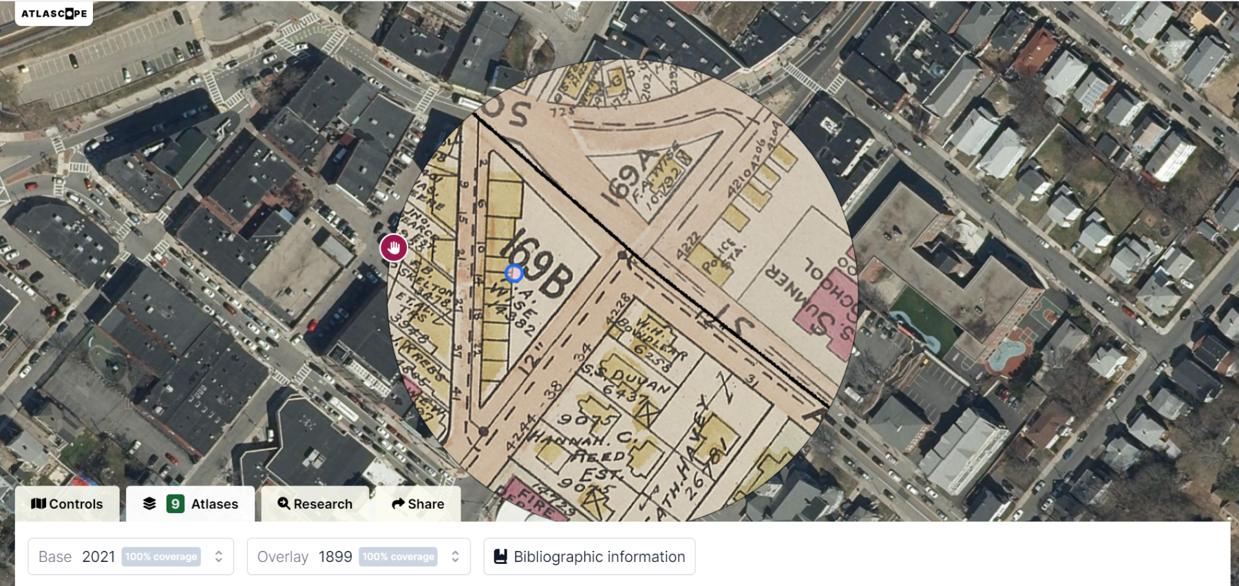
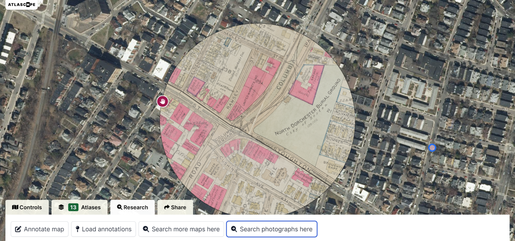
Historians are excellent at discovering information about the past. But how do they know when buildings were built, demolished, moved, or added on to or when streets were made, reconfigured, or renamed? Some of the most valuable sources of this kind of information are fire insurance maps. These maps were drawn regularly in cities across the country from the 1860s through the 1930s and they show, in surprising detail, the outline of structures and property lines, streets, parks, and other features. They typically indicate the materials used for each structure, its height, location of windows and sprinklers, the owner, and the use. This information helped predict fire hazards for insurance purposes. But today, they are invaluable sources of information about how neighborhoods have evolved over time. That is, if you have access to them.
In the past these maps could be difficult to access and tedious to sort through. But Atlascope Boston has changed the landscape of research and interpretation via digitized fire insurance maps and made them free for all and at your fingertips. The Leventhal Map and Education Center has pioneered an enriching experience for historians and the general public alike, where anyone can uncover the layers of history about their town, their own home, or any place of interest. Maps from different periods are overlaid on a modern map so that users can compare recent aerial images with historical maps to discover what has changed, or not changed, over time. And now, with a new update, Atlascope allows users to add notes and anecdotes about places. The maps also link to Digital Commonwealth, an online collection of photographs and images. With a click users can see how Upham’s Corner, for example, has evolved over the years, add a note about a store or building that used to be there or a memory of a place, and then look through old photos of the neighborhood. This tool can be used on a computer or phone, so users can compare historical maps to real places as they explore Boston. And the team plans to continue to expand this tool adding new features and more cities in the future.
“Atlascope is a gamechanger for exploring history,” says Alison Frazee, Executive Director of the Boston Preservation Alliance. “This tool has quickly become our go-to resource for information about Boston’s past and it’s so much fun to use. In fact, I discovered that my own house was moved in the 1890s to its current location from a parcel around the corner when a school expanded. I never would have known that without Atlascope.”
Developer
Leventhal Map & Education Center at the Boston Public Library
Funders
Council of Library and Information Resources (CLIR)
Associates of the Boston Public Library